 During
the three weeks we rode 714 miles (including the run from Whitefish to
Eureka for the start), and climbed 41,500 feet, at an average riding speed
of about 8 mph.
During
the three weeks we rode 714 miles (including the run from Whitefish to
Eureka for the start), and climbed 41,500 feet, at an average riding speed
of about 8 mph.
Production assistance: Duane (Lead Dog)
Trip Gurus: 'Uncle' Dave and Lou Ann Gay (Hang Dog and Lucky Dog)
The trip was conceived by Judy, Jim, and Duane. They each invited a number of their friends, and got about 13 takers. In the event Duane was not able to ride the trip owing to a back injury, and several others who'd expressed interest weren't able to make it. Judy severely gashed a leg riding a double century a month or so before the trip, and for a while we weren't sure whether she'd make it either, but she did.
During
the three weeks we rode 714 miles (including the run from Whitefish to
Eureka for the start), and climbed 41,500 feet, at an average riding speed
of about 8 mph.
Judy has also written a trip report, and Ann (the non-American on the trip) has written an article giving a British perspective on mountain bike touring in the Rockies.
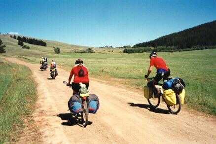
Ann and I wake up fairly early, have a quick breakfast, and then unbox and reassemble the bikes. We flew into Kalispell last night and got the taxi/airport shuttle service to run us and the bikes up to a motel in Whitefish. We're going to ride up to Eureka today. A nice ride - fairly flat run up the valley floor, good road, and not much traffic. Maybe that's because it's Sunday, or maybe because it's Montana.
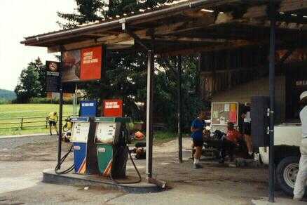
Uncle Dave, who lives in Eureka, has recommended two 'party stores' as stops enroute. These are sort of 'everything' shops - a small general store with gas pumps out front, groceries/hardware/video rental in the middle, and food/bar at the back. We have lunch at the first, where we chat with a fellow riding with a group headed the other way; others from his group trickle in as we're leaving. Stop for a snack in the second. Only two food places in 50 miles, and that's on a main road - what will the real ride be like?
Uncle Dave and Lou Ann gave us a lot of help planning the trip, and I've been looking forward to meeting them, but they're away on their summer bike tour. Sigh.
We stop to take pictures at the 'entering Eureka' sign, and then head slowly north through town, looking for the Ksanka Motel. Just as we're beginning to worry that we're heading back out of town, and we haven't seen the Ksanka, we spot two riders coming the other way. They come across, and ask if we're Ann and Paul. We admit that we are. They introduce themselves as Jim and Alan. They're headed into town to do some shopping; they point us a bit further up the road to the motel.
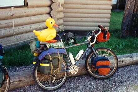
We head up and check in. Have a quick hello with the couple of people who're around. I introduce them to my mascot, a small rubber duck who rides on top of whatever's on the back rack. While we were in Pittsburgh, Ann bought me a keychain with a tiny (probably 1" long) rubber duck on it, and it's clipped to my barbag. Someone asks about it. Thinking quickly, I say, 'Oh, that's my emergency backup duck.' Ann has a rubber bathtub-toy frog on the back, and a tiny keychain frog on the barbag - the latter, of course, becomes her emergency backup frog.
The emergency backup concept develops into a running gag over the next few weeks. Any time we have two of something, the second becomes 'the emergency backup thing'. A couple weeks later we're riding up a long hill, and pass a sign for a scenic viewpoint ¼ mile ahead. Al immediately stops for a picture. As I pass by, I shout, 'There's a viewpoint in ¼ mile.' 'It's OK,' says Al, 'this is the emergency backup viewpoint.' You get the idea.
Finally we unload our bikes for a quick spin to Roosville - population 8, more or less - on the Canadian border, about 6-8 miles further north. Actually getting to the border seems important to the trip, for the sake of completeness.
We've been told that we'll be blown north and have to fight our way back, but the wind has reversed since the others rode that bit. The ride north is a battle against a strong headwind, on a roller-coaster back road parallel to the main highway. There are storms around. We can see rain and lightning in the mountains off to both east and west, but we're riding through a grey tunnel of dry clouds arching overhead. We drop back onto the main highway at Roosville, and stop for pictures. Then a high-speed run, blown back to Eureka.
Quick showers, and then outside to hang around. Melissa hares off for a spin over to Lake Koocanusa - 'hey, it'll only be 10 miles, and the group meeting's not for 45 minutes'. She invites the rest of us, but we all pass. Sounds like work. Norm hasn't arrived yet. The rest of us sit around talking, and shouting 'Hey, are you Norm?' at anyone who comes past on a bike. None of them are; he shows up later.
We have our 'formal group introductory meeting' on the benches in front of the motel at 7.30. Discuss the group gear (carrying of), cooking and chores, the 'kitty' for the buying of group food and things, and how not to get eaten by a bear. Then over to the nearby restaurant/bar/casino next door for dinner and a beer - and then to the bar across the road for another beer, probably the last for a while.
Up and over for breakfast at the bar/café/casino. Then off into town. First, hit the shops - last until Whitefish. While most of the group go grocery buying, I head for the 'sporting goods' shop, for two cans of 'bear spray' - a highly concentrated pepper spray. Also two mosquito head- nets, and a few other things.
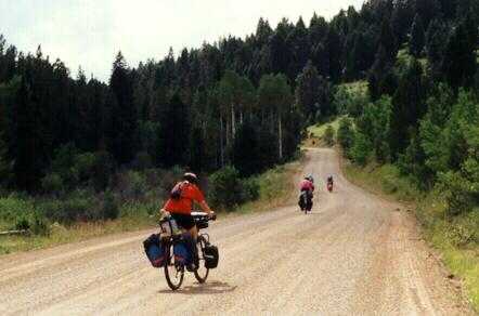
Back on the road again for a second half mile, where we stop at a very large, and very impressive, carved wooden 'Eureka' sign for group photos and a lot of playing around with cameras. Then, really off at last. We start on the old main road, a good rural track through the trees parallel to the main highway. Spot a few whitetail deer playing in the trees. Then we cut out onto the main road for about half a mile, where we turn up onto Grave Creek Road.
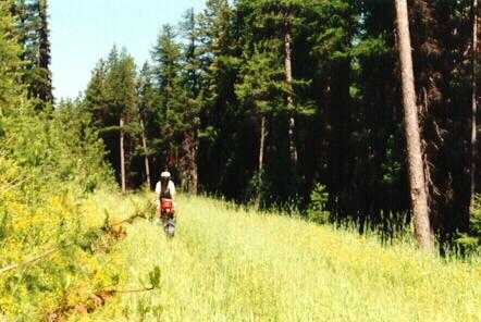
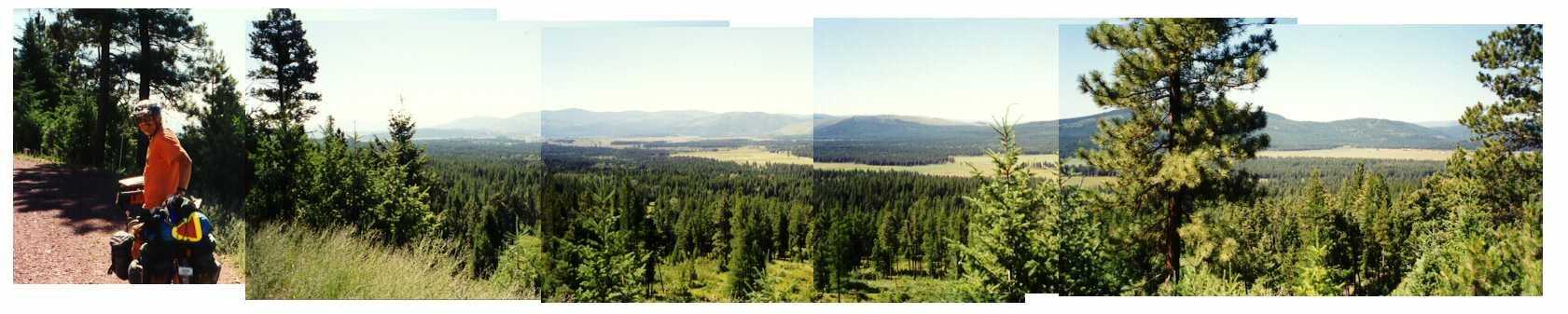
This first part can almost be mistaken for British countryside riding - the roads are a similar sort of almost-decently paved, and the trees are fairly young and look right - but this illusion keeps being shattered whenever the mountains pop into view.
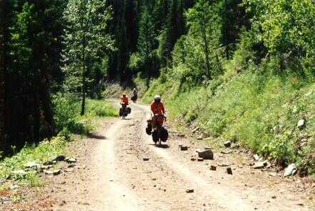 Finally,
though, it becomes definitely Montana. The road turns to gravel, and there's
a slow 16 mile climb up the mountain, followed by 5 miles of mostly
downhill,
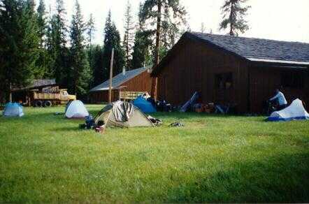
to the campsite. This is a pleasant little site. A rushing stream, with
a clear flat area beside it suitable for lazing around. Next to that a
stand of trees, mostly skinny pines, which has been semi-cleared - which
is to say, there are places large enough to put tents among the trees.
At one edge, a couple of outhouses containing pit toilets. (Most of the
sites we stay in turn out to be like this.) The whole thing is surrounded
by pine woods so dense that it's next to impossible to walk through them.
Finally,
though, it becomes definitely Montana. The road turns to gravel, and there's
a slow 16 mile climb up the mountain, followed by 5 miles of mostly
downhill,
to the campsite. This is a pleasant little site. A rushing stream, with
a clear flat area beside it suitable for lazing around. Next to that a
stand of trees, mostly skinny pines, which has been semi-cleared - which
is to say, there are places large enough to put tents among the trees.
At one edge, a couple of outhouses containing pit toilets. (Most of the
sites we stay in turn out to be like this.) The whole thing is surrounded
by pine woods so dense that it's next to impossible to walk through them.
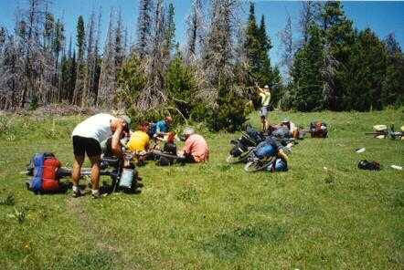
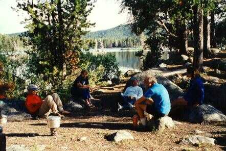
We set up camp and do the housekeeping. Jim whips up a meal involving lots of spaghetti, several cans of chicken, and who knows what else from his bag of tricks. I pump gallons of water - we're using the streams for water, and all drinking water has to be filtered to remove giardia, cryptosporidium, and other nasty little beasts. Others pump, clean up, look for bear-bag sites,
Bear bags - This is bear country. You have to keep the food away from the bears, both because you'd rather have it yourself, and because it's dangerous when a bear gets the idea that humans mean food. You also want to keep the bears away from the camp. So, all food, and garbage, and cookware, and anything else which has an interesting scent, has to be bagged up to be as unsmellable as possible. Then it has to be hung at least 10 feet off the ground, and at least 4 feet from anything the bear could climb up - like the tree you're hanging it from - and at least 100 yards from the camp. (There is some dispute about these numbers, but that's what the Forest Service recommends.) We can't find a tree with branches suitable to take everything, so we construct a huge tripod out of 3 downed lodge-pole pines, and hang the bag from that.
With all that out of the way, it's off to the tents for bed - as much to escape from the mosquitoes as anything else. Montana has a huge crop of mosquitoes this year. Not to mention blackfly, and deerfly, and horsefly, and, well, seems like if it flies and bites, they've got it.
Breakfast involves lots and lots of boiling water, plus instant coffee, instant cocoa, and instant oatmeal, with assorted types of 'oatmeal helper' - nuts, raisins, brown sugar, Standard trip breakfast, if we aren't camped somewhere where we can go out to eat. It involves minimal preparation and cleaning up, so we can get on the road. Melissa says that she woke up in the middle of the night and saw a moose next to her tent - everyone else slept through it.
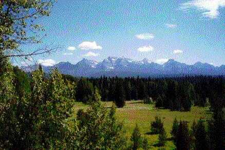 The
day starts off fun, with a long coast - about 8 miles on decent dirt road
- down from Tuchuck into the valley of the Flathead River. The Flathead
is the boundary of Glacier National Park, and there are beautiful views
of snow-capped mountains in the distance as we ride down to it, so we make
frequent stops for pictures.
The
day starts off fun, with a long coast - about 8 miles on decent dirt road
- down from Tuchuck into the valley of the Flathead River. The Flathead
is the boundary of Glacier National Park, and there are beautiful views
of snow-capped mountains in the distance as we ride down to it, so we make
frequent stops for pictures.
We run along the flat beside the river for a while, stopping to admire the view from time to time, and finally hit the turn for Red Meadow Lake. Just before the turn, Carl drops off. He's having front pannier trouble, he says. He'll tighten them up, and then catch up. The rest of us start the 15 mile climb.
Probably about half way up, I have a puncture. Ann & I tell everyone that we have it under control, so they go on. I mend the flat - rear tire, of course - and discover I also have a broken spoke - miraculously, on the non-drive side, and strangely, at the nipple rather than the elbow.
While I'm mending that, a strange fellow rides up, and introduces himself as 'Peter'. He's riding a full-suspension bike, and pulling a BOB trailer. He has his phone number painted on every single tube of both; eventually, we christen him 'Peter 208', after his area code. He proceeds to tell me how I should be replacing the spoke, and he explains in great detail exactly what's wrong with my bike, and exactly what's right about all of his, including not only the humble steed he's riding, but also the incredibly expensive one waiting for him at home, each individual joint of which cost large amounts of money to weld.
I work my way through all of that - replacing the spoke, mounting the tire, not committing murder (though no jury in the world would have convicted me). I'm cleaning up and packing things away when a ramshackle pickup pulls up. In the cab are an attractive mom and 3 cute (too-)young teenage-sized daughters. 'And, I've got 3 [or was it 5?] more of them back t'home.'
In the back of the truck is Carl with his bike. Carl's back rack has broken, so he's flagged down this pickup, and talked them into giving him and his bike a lift to the bike shop in Columbia Falls, where he can meet us tomorrow. Or so he says. I ask whether, just maybe, he spotted this pickup full of good-looking women coming down the road, and realised that if he could break something, he'd have an excuse to hitch a ride.
Whatever the true story is, he also talked them into first making an excursion up the mountain, so he can let us know. I find out later that Carl is a salesman. If you're ever in Alaska, and see igloos with air- conditioners hanging out the back, you'll know Carl's been there.
Carl has a share of the group stuff - mainly a large pot and lots of carrots - which we take and pack away; then we say goodbye. Except, oops, the truck won't start. So the whole bunch of us push-start it. Then Ann and I wave them off and set off up the hill again. A few hundred yards along, around a bend, we find Jim, lying by the side of the road with his hat over his face. Just napping, he says, waiting for the stragglers to catch up. We explain about Carl, and then we all set off to Red Meadow Lake. We can see Peter 208 crawling up behind us, but by unspoken agreement we've decided to push hard enough to stay ahead.
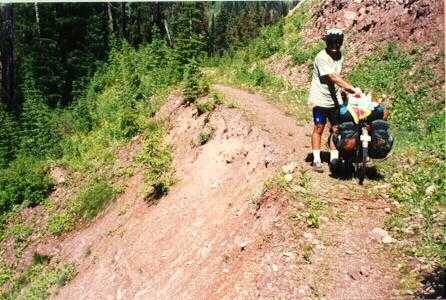
This is a pretty nasty ride - the surface is really rough, and in places it degenerates from real dirt road into something more like a pair of Jeep ruts. We all have to walk parts of it. I'm drying out, and have to stop several times to filter water from roadside streams to refill my bottles; and, towards the top the roadside streams stop showing up. I decide I definitely see a CamelBak in my future.
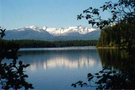
The campsite is a beautiful, and fairly open, site by a lake. Most of us dip more or less of ourselves to get clean, but it's cold - fed by melting snow, of which there's a small patch just uphill from the tents. (We go up later to throw a few snowballs.) I think that Ann, Melissa, and I may be the only three to get fully immersed - Missy says that my scream as I hit the water is truly impressive. Missy also says she's 'real impressed' with how long Ann stays in. Ann says that she didn't mean to, but that she missed her footing and went in over her depth, and she had to swim around for a while before she found somewhere she could stand up.
Peter 208 shows up, and proceeds to bitch about our choice of tent sites, our cooking methods, our bear bags, Finally Jim gives him a few choice words, and he slinks off. (Jim's a kindly soul, but he's not called Big Dog for nothing. I suspect that he might make an impression.)
Alan - who's going for the role as group joker, in line with his Party Dog title - has some 'Police Line - Do Not Cross' tape, and it appears in various places around the campsite.
Meanwhile, Judy begins what will become a trip ritual - The Swapping of The Tire. She's been having traction problems, and she's replacing the fairly slick tire on the back of her bike with a slightly knobblier folding tire she's carrying. She gets to do this twice this time; as she's putting the wheel back onto the bike, I spot that she's mounted the tire for the wrong direction of rotation. 'What!?! Tires are directional?' 'Yep.'
I get involved in the bear bagging this time. Al's found a nice tree which will take most of the stuff, and we have a good time trying to get a rope over the right branch, and far enough out. Eventually we succeed, and hoist most of the stuff.
Another group is setting up a second bag, for the last minute stuff. They've found two branchless trees about the right distance apart, and have managed to get a rope across between them at a good height. Having observed Al's and my success on our tree, they ask if I'd toss the lifting rope over this line. They give me the rope, which has a carabiner on the end, and I toss it. The carabiner clips onto the cross rope. Couldn't have done that in a million years if I'd wanted to, and we have a good laugh about it. Fortunately, the throwing rope is long enough that we're able to leave that, and work with the other end. (Advice - get a locking-gate carabiner for this job, and lock the gate before throwing it.)
Yesterday evening several of the group said they'd seen a bear high up on the hillside across the lake. Ann and I missed it, so during breakfast and packing time we keep our eyes peeled. Sure enough, eventually she shows up; a momma grizzly with 2 cubs, grazing merrily among the bushes. Fun to watch, and they're at a reasonably reassuring distance - i.e. just in binocular range and on the other side of the lake.
 Finally
we finish with the morning stuff and the bear-watching, and we hit the
road. It's almost all downhill today - a great change. The first
maybe 25 miles are nice off-road, and then finally we come out onto the
paved road along the East side of Whitefish Lake, which goes on into town.
Ann says the lakeside bit reminds her of the English Lake District.
Finally
we finish with the morning stuff and the bear-watching, and we hit the
road. It's almost all downhill today - a great change. The first
maybe 25 miles are nice off-road, and then finally we come out onto the
paved road along the East side of Whitefish Lake, which goes on into town.
Ann says the lakeside bit reminds her of the English Lake District.
I'm riding with the tail-end group, but on the flat as we approach the town I pull out ahead. Come to the final uphill, up into Whitefish, and there by the side of the road is a sign saying 'Cycle on Roadway'. Why, I wonder? We too hard to hit if we're on the shoulder?
That's unfair, really. The Montana drivers we've come across have given us lots of room, and occasionally they even stop to let us get back together if half of us have managed to cross a road, and the other half are obviously waiting.
At the top of the hill into town, I hear a shout. I look around, and there's Jim. As threatened, he's stopped at the first place along the road which sells root beer. I pull in to join him, leaving my bike out by the roadside so the people behind might spot it. There are a couple of tables set up in a courtyard at the side of the shop, and Jim's sitting at one of them.
I wander around to the front of the shop, and outside is a long set of trestle tables covered with crates of fruit. I'm accosted by an attractive young woman at the fruit display -
You looking for biker snacks?
How'd you guess? Got ESP?
Naw, I ride too.We chat a bit while I pick out a nectarine and an apricot - she tries to convince me the nectarines aren't quite ripe yet, but it turns out to be great - and then she washes them off. I take them inside to pay for them, a bottle of iced tea, and a bottle of root beer. I join Jim at his table, and we sit outside munching and drinking while the rest of the mob trickle in.
Once we all feel human again, we set on up the road to our planned motel/campsite. The owner wants $14 apiece for us, which we think is excessive for just a couple of tent sites. So, Carl gets on the phone - we've picked him back up as we passed through town. He gets the KOA to agree to take us for appreciably less money, so we decide to go there.
Enroute through Whitefish we hit the shops, where Ann and I buy, among other things, our dream CamelBaks. Al buys a T-shirt from the bike shop. The woman there recognises him, and asks why he didn't buy it on Saturday when he was in. He says he didn't want to carry it the extra few days, and he knew then that he'd be wanting a clean T-shirt about now.
One problem with the KOA, though. No local food. It's well out of town, and it's at the bottom of a large hill that we don't want to ride up again tonight. So, we put Carl back on the phone, phoning around to all the local restaurants. He spends ages - most of the local restaurants don't want to know - but eventually the Pizza Hut agrees to make us up some pizzas and have them driven over. So, pizza for dinner, delivered right to the tent flaps.
KOA has a hot tub, so some of us sit in that. It's also got a coin-op laundry, and we all go wild washing everything. This turns out to be pretty much standard practice, wherever there's a washing machine. Running water, too, so proper showers. We have a short chat with another couple of cross- country cyclists who wander by our site.
We've gone off-route to get to the KOA (pronounced kay-way by the locals), so we decide to recover by riding the main road to Columbia Falls. First, though, there's the all-you-can-eat KOA breakfast. The only two choices are ham/no ham, and 'how do you want your eggs'. We set to that - 2 eggs, pancakes, potatoes, ham, and coffee to start, plus more of any of the above that appeal. We massacre that, including a round or two of extra helpings. (Believe Judy said the pancakes are the first she's met that you need a knife to eat.)
Then we head for another bike shop, this one in Columbia Falls, since Tom wants his bottom bracket checked. For some reason we aren't riding as a single group. When I get there, Tom's about done - his BB is all right - and we chat a little with a young woman who's cycling on up to Glacier.
Most of the rest of the bunch dribble in shortly afterwards, and decide to go up into town to find the post office, and to check out a steam engine which is on display. Ann and Norm still haven't shown up, so I ride back to see if there's some problem. About a mile and a half back, I find Norm mending a puncture. Ann has just got there too, having had and fixed her flat a few hundred yards further back.
Finally we all manage to get together, and head to the A&W just outside town for lunch. I introduce Ann to root beer there. Doesn't seem to convince her; she observes that 'it must be an acquired taste'. After lunch, it's mostly a simple, and flat, ride down to Big Fork. This is interesting mostly by virtue of being along 'square' roads. The road pattern still shows the basic 1-mile grid pattern of the early landrush days. So, it's a mile east, mile south, mile east, , with slight variation, for a lot of the afternoon. A minor highlight - at one point we pass an area where the road shoulders have been replanted. Among the vegetation are small signs:
The idea of a county 'weed department' just slightly boggles the mind.
 A
few miles before Big Fork we stop to regroup and snack at the general
store/gas
station in Swan River. This trip is requiring serious alterations to our
sense of scale. The town of Swan River (must be a town, it's on the map)
appears to consist of a cross-roads, with a single building on each corner
- and that's it.
A
few miles before Big Fork we stop to regroup and snack at the general
store/gas
station in Swan River. This trip is requiring serious alterations to our
sense of scale. The town of Swan River (must be a town, it's on the map)
appears to consist of a cross-roads, with a single building on each corner
- and that's it.
Eventually we settle into the campground at the Timbers Motel and RV site just outside of town, another luxury site, which is to say with running water, and we wander in for some sightseeing. Big Fork has turned into an artist's colony. We note several places to check out the next day, and Judy spots the theatre and decides that one way or another, we're going to see a play before we leave.
Back at the site we engage in various forms of mascot abuse. I'm travelling with Duck (and Emergency Backup Duck), and Ann has Frog (and E.B. Frog). Judy rides with the world-famous Rufus (Turre Bear), Jim has George (George George of the Jungle, a rather soppy - sorry, George - gorilla), Al has a Daffy Duck bicycle horn, and Melissa has Bucky (a beaver, purchased just across the border in Canada at the start of the trip; there'd been a move to name him Cleaver the Beaver, but Missy vetoed that). Most of the mascots have the sense to hide in their tents, but someone finds Bucky and hangs him from a tree at the campsite, using one of the bear ropes (and a very nice hangman's noose). Melissa suspects Jim, so when she rescues Buck she strings George up in his place.
Later we head into town for a meal at the Italian restaurant. We have some wine, and Carl, feeling left out of the mascot game no doubt, adopts the wine bottle cork as his mascot, 'Corky'. When we get back to camp, Corky too gets hanged.
 We
spend most of the day sightseeing and shopping. There are a lot of
interesting
little shops in Big Fork - if you like art colonies, anyway - and we have
to check them all out. The toy shop has a very tempting, and very large,
moose arm puppet, but we manage to resist that by thinking about what it
would be like to carry it; though there was some contemplation of the fun
it might be, sticking it through someone's tent flap in the middle of the
night.
We
spend most of the day sightseeing and shopping. There are a lot of
interesting
little shops in Big Fork - if you like art colonies, anyway - and we have
to check them all out. The toy shop has a very tempting, and very large,
moose arm puppet, but we manage to resist that by thinking about what it
would be like to carry it; though there was some contemplation of the fun
it might be, sticking it through someone's tent flap in the middle of the
night.
Ann, Carl, Judy, and I walk up to the 'mall'. I go mad at the sporting/hardware shop, and buy (among other things) a pack of stick-on bulls-eyes, for target shooters. Will be worth the cost, I think, to stick one on George. On the way back we discover a small shop selling huckleberry fudge, which leaves Judy in seventh heaven. In town we find a shop selling Jelly Bellies (jellybeans), which pretty much makes Melissa's day.
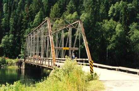 During
this excursion we stop at the tourist office. We mention the bridge
we took into town, which looked like it could stand resurfacing.
'Oh yeah', says the lady there, 'we're going to be taking that down any
time now. 'Later this summer?', someone asks. 'No, I mean any
day now. Maybe tomorrow, if they get around to it.' Plan is
to replace it at some point, after the old structure is out of the
way.
Wonder if it's gone yet.
During
this excursion we stop at the tourist office. We mention the bridge
we took into town, which looked like it could stand resurfacing.
'Oh yeah', says the lady there, 'we're going to be taking that down any
time now. 'Later this summer?', someone asks. 'No, I mean any
day now. Maybe tomorrow, if they get around to it.' Plan is
to replace it at some point, after the old structure is out of the
way.
Wonder if it's gone yet.
I spend a lot of the afternoon lazing in the motel hot tub, and chatting with Carl and Jim. The assorted candies have been left on the communal food table, and we all spend some time sampling the fudge, and various Jelly Belly combinations as suggested by the hint sheet. And, of course, more laundry, since the campsite has a coin-op. Then into town again. We have dinner at the Mexican fast-food place, and then troop over to the theatre to see a play - 'Big River', a musical adaptation of 'Huckleberry Finn'. Somehow, Al and Judy have managed to get 10 tickets - a block of 6 and one of 4 - for this 'sold-out' show. It's a lot of fun.
There's a 'tourist bus' back out to the campsite, and after the play we head for it. Six of the group, including Ann, manage to get on, then notice the rest of us are missing. Ann gets back off to get us, but when the rest of us get there the bus is full, and has started to roll. So we wave goodbye to the five who've got on, and the remaining 5 of us - Ann, Judy, Tom, Missy, and I - go for a beer at a very loud bar. Melissa proclaims herself to be feeling 'tiddly', a word we seem to have brought over from the UK and which she's decided she likes.
At last we all walk back to the camp to get some sleep.
Today starts wet. It's immediately further marred when Jim, who's phoned home, announces that he has to leave the ride to return home. His wife's mother is in the hospital. We gloomily absorb that news, and then get down to the business of working out how that changes the logistics. In addition to carrying a share of the group gear (much of which he owns), he's also performing a number of specific roles - including co-ordination of food buying, minding the group kitty,
We divide up the roles and the gear between the rest of us; Al agrees to ship Jim's stuff back to him when we finish the trip. Jim says that the coffee pot is almost dead, so he doesn't really want to get it back - unless we can steal Bucky and slip him inside it. (Missy keeps a pretty close eye on Buck after that.) Once we've sorted everything out, we traipse back into town for breakfast.
Eventually we get packed up, say goodbye to Jim, and set off again. Tom and Missy, who seem to be our two best (or at least, most stubborn) off-roaders, elect to stick to the recommended route, on the fire roads to the west of Swan Lake. The rest of us decide, because of the rain, to ride the road along the east side of the lake, at least as far as the south end of the lake where there's a chance to pick up the route again.
We stop for lunch at a picnic ground just before the town of Swan Lake, which is near the south end of the lake. It seems like it has almost stopped raining, but it starts again as we finish, so we head into town, to the post office/general store/etc, for a cup of coffee. This turns out to be a good choice; the place seems to be a major social venue for itinerant cyclists. There's a young Dutch touring couple there when we arrive, and we talk to them for some time. They're heading north, but on-road.
 Then,
as we get ready to leave, in comes a young woman named Lauren, from Kansas,
who's cycling to Canada at high speed, over 100 miles/day on-road. We have
a long chat with her, too. Alan turns out to be familiar with the parts
of northern Montana and of Canada that she'll be passing through, so he
runs off a list of things to see, things to miss, places to stay,
; and
we get a few hints from her in return. During the course of all this, we
discover that she and Alan have a mutual friend in Emporia, Kansas - how
likely can this be? - and so a certain amount of pure socialising is
necessary
as well; 'hey, and do you know so-and-so?'
Then,
as we get ready to leave, in comes a young woman named Lauren, from Kansas,
who's cycling to Canada at high speed, over 100 miles/day on-road. We have
a long chat with her, too. Alan turns out to be familiar with the parts
of northern Montana and of Canada that she'll be passing through, so he
runs off a list of things to see, things to miss, places to stay,
; and
we get a few hints from her in return. During the course of all this, we
discover that she and Alan have a mutual friend in Emporia, Kansas - how
likely can this be? - and so a certain amount of pure socialising is
necessary
as well; 'hey, and do you know so-and-so?'
At this point we've passed the worst climb, and the weather's clearing, so we cross back over to the fire roads south of Swan Lake, and ride down to Cedar Creek to camp. Problem, Cedar Creek campsite is a sea of mud, occupied only by an old pickup mired to its axles, and with a tarp made up into a lean-to alongside it. This is the camp of a fellow who allows as how it might be the only useable spot on the site, and even it isn't that great. Second problem, Tom and Melissa are supposed to meet us here. They're both fast riders, and even allowing for the fact that we were on- road for a lot of the time, and they off-road, we've been expecting them to beat us by a long margin. The fellow with the pickup says no, he hasn't seen them.
He agrees that if a couple of cyclists show up, he'll tell them where we've gone, and we head a mile or so east back to the main road, where we think there's another campsite. There isn't. However, there's a forestry station, and there are people at it. We send someone over to talk to them, and learn that there isn't another nearby site. So, Carl goes to work, and convinces them to let us set up camp in the grassy area behind their building. This is workable; there's a dilapidated outhouse back there - apparently rendered obsolete when the water supply was put in - and there's an outside faucet and garden hose which solves our water problem.
 We
start setting up camp, hosing off the bikes and ourselves. A couple of
us go back up to the road to put up a 'we are here' marker for Tom and
Missy, when Al spots them riding south down the road towards us. They had
indeed got there well before us, and found that the campsite was unusable.
They thought we'd stay on the road all day, so they headed north on the
road thinking that they could intercept us heading south. After 5-10 miles,
they decided that they must have missed us somehow, and they turned back
to Cedar Creek. They're absolutely caked with mud - looks like they've
both been dipped in a vat of Dairy Queen chocolate dip.
We
start setting up camp, hosing off the bikes and ourselves. A couple of
us go back up to the road to put up a 'we are here' marker for Tom and
Missy, when Al spots them riding south down the road towards us. They had
indeed got there well before us, and found that the campsite was unusable.
They thought we'd stay on the road all day, so they headed north on the
road thinking that they could intercept us heading south. After 5-10 miles,
they decided that they must have missed us somehow, and they turned back
to Cedar Creek. They're absolutely caked with mud - looks like they've
both been dipped in a vat of Dairy Queen chocolate dip.
We have our first dinner bought and prepared without Jim's expert advice; a masterpiece by Alan and Judy. At least we seem to be able to feed ourselves. After, seems like a good time to have a bit of fun, so in the absence of George, I stick one of my self-stick bulls-eyes onto Bucky.
This turns out even better than I'd hoped. Alan has acquired the role of group joker, so Melissa is certain that he did it. Alan doesn't know I have the bulls-eyes, and he didn't see it stuck on Bucky, so he's protesting, totally honestly, that he doesn't have any idea what she's talking about. However, he's already demonstrated the ability to carry off a fairly convincing 'Who? Me?' line, and Missy is convinced that he's simply doing that even better than usual. Much merriment ensues, before sanity finally returns and we head off to our tents. It's been a pretty easy day; very muddy, but mostly downhill.
Quick start, to get out of these folks 'back yard', and up and over
a fine little hill. After maybe 10 miles, part of the group decides to
cut back over to the road for the rest of the day. We stand at a 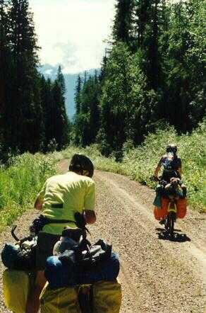 junction
for a while, discussing this. Tom and Melissa, as usual, are way ahead,
and probably more or less on the notional route. Al, Ann, Norm, and I want
to continue off-road. Judy, Carl, and Alan opt for the road and head off.
There's a strange-looking stick here, at the junction, that we've been
standing around, and as our group heads off I give it a kick. Isn't a stick
after all. It's the lower leg bones, hoof to knee, of something like a
large deer, or small moose - that kind of animal - with most of the meat
and skin chewed off. Wonder who (or what) left that there. Maybe I'm happier
not knowing.
junction
for a while, discussing this. Tom and Melissa, as usual, are way ahead,
and probably more or less on the notional route. Al, Ann, Norm, and I want
to continue off-road. Judy, Carl, and Alan opt for the road and head off.
There's a strange-looking stick here, at the junction, that we've been
standing around, and as our group heads off I give it a kick. Isn't a stick
after all. It's the lower leg bones, hoof to knee, of something like a
large deer, or small moose - that kind of animal - with most of the meat
and skin chewed off. Wonder who (or what) left that there. Maybe I'm happier
not knowing.
We carry on, twiddling up a rough and muddy hill. On one particularly rough patch, Ann falls. I hear her (she's behind me), and stop to make sure she's OK. Al suffers from a momentary lapse of attention, runs into me, and falls over too. Everyone is OK, but Al has knocked his shift lever, leaving his chain in a 'no-grip' position, and when he tries to set off, he falls over again - but the other way, just to balance things out. Later, on a muddy bit, Norm falls over. I'm congratulating myself for being the only one having no problems, when my rear tire flats. Sigh.
 At
last we pull into the campsite by the lakeside at Holland Lake. This is
a beautiful site, trees right down to the lake. The early two bunches have
already staked our claim to an area, and they've left directions for us
pinned to a post at the entrance.
At
last we pull into the campsite by the lakeside at Holland Lake. This is
a beautiful site, trees right down to the lake. The early two bunches have
already staked our claim to an area, and they've left directions for us
pinned to a post at the entrance.
While we're setting up camp, and I'm mending a tube or two, a 4x4 pulls up to the parking place next to our site, and the driver hops out to accost the group. Oh, oh, we wonder, who's this and what are we doing wrong? Turns out to be Uncle Dave and Lou Ann, who knew that we planned to be here this evening, and drove down from Eureka to see if we made it. And, they brought a coolbox full of beer.
Mixed feelings here. It's really good to meet them at last; I'd been disappointed to find that they weren't home in Eureka. On the other hand, they're only back in Montana because their own holiday was cut short when Lou Ann was hit by a car, somewhere in Iowa. She's been in the hospital for a while, and they only got back to Eureka today. Sounds pretty serious, but by now Lou Ann seems to be recovering well, though she's still having some problems with an ankle, leaving her on crutches. Would be nicer if it didn't take something so drastic to make the meeting possible.
As usually happens when I finally manage a face-to-face meeting with someone I've known a long time on the net, Uncle Dave and Lou Ann don't look anything at all like the picture my imagination has built up for them. Interestingly, though, Uncle Dave is a dead ringer for what I expected Jim to look like; and Jim had looked pretty much like what I've been expecting of Uncle Dave.
There's a fancy lodge with a nice restaurant over next to the campsite, where we had our showers earlier (cost a buck or two), and we all, including Dave and Lou Ann, go over for a real nice dinner and a lot of talk. Finally Dave and Lou Ann set off back for home, but with a threat that we might see them again.
 Wake
up in the morning to find a ransom note sitting on Ann's back rack: 'If
you want to see Duck again, leave a chocolate chip cookie
'. It's signed
by Bucky. Duck's been kidnapped! Is this Buck's revenge for me sticking
that bullseye on him?
Wake
up in the morning to find a ransom note sitting on Ann's back rack: 'If
you want to see Duck again, leave a chocolate chip cookie
'. It's signed
by Bucky. Duck's been kidnapped! Is this Buck's revenge for me sticking
that bullseye on him?
Oops, no, Duck's still sitting in my helmet, where I left him last night. It's Ann's Frog that's missing. 'Looked like a duck in the dark,' sulks Melissa; 'Kinda hard to tell them apart.' Guess beavers can't see very well at night. Missy edits the note, changing 'duck' to 'frog', and puts it back on Ann's rack. 'Gee,' says Ann, 'where am I going to find a chocolate chip cookie?' Melissa lends her one, so she can buy back Frog from Buck. Honour is satisfied.
The group then decides to split up for the day. There's supposed to be a nice waterfall nearby, and Judy wants to hike up to see it, and then catch up by bombing down the road to Seeley Lake. Ann and a few others concur, wholly or in part. Tom and Melissa want to hit the fire roads - today's supposed to have some impressive off-road stuff, plus there's Clearwater Lake along the way. Al wants to ride the off-road too, but doesn't want to hold back Tom and Missy, and doesn't think it would be a good idea to ride it alone. Fortunately, he says so, because I've been thinking along the same lines, but hadn't thought to mention it. So, the four of us decide to hit the high trails.
We set off out of the campground together, but as we hit the entrance Tom decides that a latrine stop would be a good idea; he tells us to go on, and he'll catch up. We do, but when he hasn't overtaken us after about 6 miles, Melissa decides she has to go back to look for him. She says he always stops to wait for her if she falls behind, and she feels guilty not waiting for him. Riding hasn't been too tricky so far, so we three agree that it's OK for her to go back alone, and then the two of them can catch up - at Clearwater Lake, if not sooner.
 Al
and I continue on, along a double-track - a sort of jeep trail - which
has been overgrown into a meadow of tall flowers. Really pretty, but a
pain to ride through; the plants keep grabbing the bike. At the end of
that, about 9 miles into the day, Tom and Melissa catch up. Tom had
speedometer
problems, and didn't like the idea of trying to navigate without it, so
he stopped for a bit to fix it.
Al
and I continue on, along a double-track - a sort of jeep trail - which
has been overgrown into a meadow of tall flowers. Really pretty, but a
pain to ride through; the plants keep grabbing the bike. At the end of
that, about 9 miles into the day, Tom and Melissa catch up. Tom had
speedometer
problems, and didn't like the idea of trying to navigate without it, so
he stopped for a bit to fix it.
We bash on to Clearwater Lake where we've decided to stop for lunch. There's a wide parking spot in the road, and the lake is about ½ mile down through the woods, along a narrow, rough and root-covered path. Tom and Missy ride down that. Al and I try that for maybe 50 feet, then try walking the bikes for another 50, and then decide to push the bikes back up to the road, lock them up there, and walk down to the lake. Have lunch sitting by the lake. Melissa, Duck, and Tom go in for swims. Al and I pump water to refill everyone's bottles and CamelBaks. Then we sit for a while and watch a little wildlife drama - a skinny green tube (which we decide must be a leech) lunching on a reddish-brown ribbon (which we decide must be a flatworm) near the edge of the lake. Looks almost like a balanced fight for a while, but then a second green tube joins in, and it's all over for the ribbon. Nature in the raw.
After lunch there are a couple of miles of pleasant rolling terrain. (Anyone doing this ride using a trailer, I recommend taking the cut-off back down to the road along this stretch, just past Clearwater Lake. There's a part coming later that won't be a lot of fun if you're pulling a trailer.) Then you start a 5.5 mile climb. The ACA map calls it 'steep'. We don't think it's particularly steep, but it's a persistent and unremitting climb, and combined with the rough trail conditions it takes Al and me about 2 hot hours to get to the top of it. The CamelBak really earns its keep. According to the ACA route profile, we peak at an elevation of about 7500 feet. From my altimeter and studying the contours on the De Lorme map, I don't believe that, though; I reckon something more like 6500-6700.
 Then,
according to the map, you 'cross gate; road becomes more primitive
'.
They're
not kidding. There's a sign on the gate, saying the road is closed, but
Tom and Missy's tracks go through, so we do too. The 'road' (and such it
may have been, once) is a sort of notch carved into the side of the
mountain,
so that you have the flat road surface, with a 6-10 foot vertical wall
on the right, above which the hill reverts to its normal upward slope.
On the left is a drop-off, at whatever angle the original slope had. In
the 'good' stretches, this is double-track, a jeep track. In the bad
stretches
there've been slides reducing it to a ledge a couple of feet wide; on those
bits, the drop-off, while not sheer, is a typical scree slope of the kind
you don't want to go over with a bike.
Then,
according to the map, you 'cross gate; road becomes more primitive
'.
They're
not kidding. There's a sign on the gate, saying the road is closed, but
Tom and Missy's tracks go through, so we do too. The 'road' (and such it
may have been, once) is a sort of notch carved into the side of the
mountain,
so that you have the flat road surface, with a 6-10 foot vertical wall
on the right, above which the hill reverts to its normal upward slope.
On the left is a drop-off, at whatever angle the original slope had. In
the 'good' stretches, this is double-track, a jeep track. In the bad
stretches
there've been slides reducing it to a ledge a couple of feet wide; on those
bits, the drop-off, while not sheer, is a typical scree slope of the kind
you don't want to go over with a bike.
There are small - about handlebar high or so - pines growing right up to, and between, the pair of tire-tracks that make up this 'road'. These keep trying to grab the bars or the front panniers, to steer the bike off in funny directions. Just to top it off, in places trees higher up the mountain have fallen, and they're slanted down across the road 'notch' - some high enough that you can squeeze under if you lay the bike sideways, some so low that you have to lift the bike over them. We walk a lot of this stretch. Some of that is downhill, and it's really annoying having to walk downhill. We have to carry the bikes at several points. There are beautiful views from this track, but you have to do an awful lot of work to earn them. We run across 3 Canadian walkers on this stretch, and we talk with them a bit.
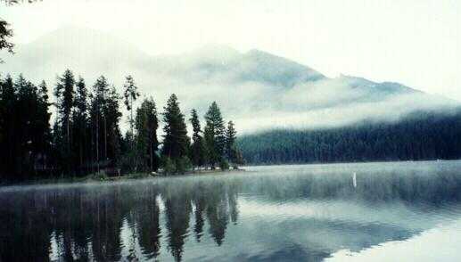
Eventually we clear that tangle, and get the payoff for all that work. First, a view of a beautiful forested natural amphitheatre, and then a clear 10-12 miles of mostly downhill, high speed coasting on a reasonable dirt/gravel surface, to Seeley Lake. I have a feeling that a week ago I'd have probably called that road surface marginal, and taken it pretty carefully, but after everything else we've ridden (or pushed) today, it's wonderful. Everyone else is already in camp, they've put up markers leading Al and me to the site, and they're only just starting to worry about why we haven't showed up yet. We have a pair of pitches (or sites) in clearings in the woods on opposite sides of a road through the campsite.
We go into town for a shower - there's a laundromat in town, which has two shower rooms - and to have dinner at the bar next to the laundromat. When we get back to the campsite we can hear rumbling off in the distance; Judy, Ann, and I, and later some of the others, wander over to the campsite's boat ramp. From there we can watch lightning storms brewing up behind the distant mountains over the lake - Nature's own fireworks. We watch them move slowly over the mountains and across the lake, while we guess the distance by counting the time between the flashes and the bangs. Living in the city, sometimes you forget how wild nature can be; this is a good reminder. When it becomes clear that the storms are just about to reach us, we head back to the tents, and tuck ourselves in just as the rain starts falling through the trees.
A couple of folk spotted an interesting looking restaurant down at the far end of town from the campsite, during the day, so we decide to go down there for dinner. Turns out they aren't really set up for dinner, specially not for large groups. They have only one 'full meal' menu selection, of which there are only 2 helpings left - though, apparently not knowing cyclists' appetites, they suggest that they can probably divide them to serve 4 of us; and they can do some of the 'lunchtime' sandwich choices. We thank them, and leave to find somewhere else. Next stop is a steakhouse up the road. Looking back, I'm not completely sure why it surprised us, but steak - 16 ounce size - is the only thing that they serve. Not everyone wants a steak, so after a bit of soul-searching we walk out of there too. We end up back at the bar, same place as we were last night. Cheerier waitress this time, though.
 Off
to the café about ½ mile north of camp for breakfast - same
place we had breakfast yesterday. There's a bit of confusion around the
table, people coming and going, but I think nothing of it. Go back out
to the bike after breakfast to discover that Duck has turned into Big Duck.
Someone has moved my little rubber duck mascot from the top of my load,
and strapped on a 1½ foot high inflatable plastic duck. Much
laughter.
Rumour has it that Judy and Carl just might have some idea who was
responsible.
Off
to the café about ½ mile north of camp for breakfast - same
place we had breakfast yesterday. There's a bit of confusion around the
table, people coming and going, but I think nothing of it. Go back out
to the bike after breakfast to discover that Duck has turned into Big Duck.
Someone has moved my little rubber duck mascot from the top of my load,
and strapped on a 1½ foot high inflatable plastic duck. Much
laughter.
Rumour has it that Judy and Carl just might have some idea who was
responsible.
Ann says later that when she went in, there was a lot of fuss about where she was allowed to sit - she wondered why everyone was trying to confuse her so early in the morning, before she'd even had a cup of coffee. Turns they wanted to make sure that when I got there, I'd have to sit with my back to the door and window so I couldn't see what was going on.
After we recover from the laughter - at least, enough to ride - and have a photo session, I move Duck back up to sit beside Big Duck, and we hit the road. Day starts with a long, fairly gentle and very pretty climb through the Lolo National Forest. Then we drop down to run along the Cottonwood Lakes. Tom and Melissa are way ahead. Norm, Carl, and Alan make up the second bunch, and Al, Ann, Judy, and I are in the tail-end group. The four of us stop for a few minutes to chat with a fellow camping down at the lakes, which puts us a bit further behind.
We hit Ovando for lunch at a general store, which originally was a saloon and brothel. Tom and Missy are there; the other three aren't. We sit around, munching, chatting to the store-keepers, and occasionally wandering inside to buy some more stuff to munch, for about an hour. Then we decide that Norm, Carl, and Alan must have skipped the town - must be way ahead of us - so we decide to set off.
We cycle out of Ovando, heading east along the main road to a dirt road turnoff a couple miles ahead, signposted for Big Nelson Lake. Tom and Melissa are miles ahead again - our strongest riders by far, and almost impossible to hold back. Occasionally we've seen them during the day; this usually means they've taken a wrong turn, realised it after a few miles, checked the map, backtracked, picked up the trail behind us, and zipped past into the distance again. (Looks to us like 'getting lost', but they insist it's 'trail research'.)
Carl, Norm, and Alan are actually well behind. They missed a turn earlier, and spent an hour or two on an unnecessary climb of Morrell Mountain, or maybe Monture Mountain, until they came across a ranger -
Howdy, ma'am. Fine day today. (I imagine this being Carl.)
Sure is. Say, where you fellows headed?
Why, we're taking this here fire road to Ovando.
No, you're not. This deadends up top of the mountain, a couple miles ahead at the fire lookout. You wanted the right fork, back down the bottom where you turned up the hill...
Oh s.......Followed by a bit of map-waving. We meet them as we're leaving town. They're just coming in and are going to stop for lunch. We decide not to wait.
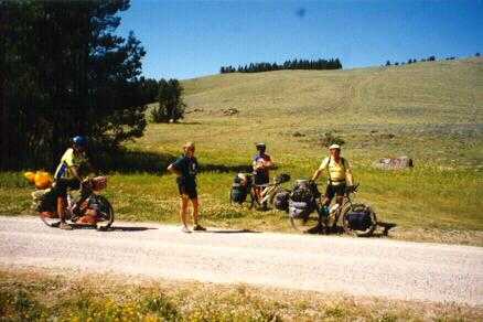
So, there are just the 4 of us heading east on the main road, pretty spread out. Judy in the lead, then Al, then me, then Ann, probably a hundred yards or so between each of us. The turnoff is near the top of a long gentle rise, just before the highway crests the hill and swoops back down into a valley. I get to the turnoff. Al's standing by the side of the road. 'Judy missed the turn,' he says. I probably should have seen that, but I was watching the shoulder for roadkill. Al says, 'I'll go chase her down.' He takes off and vanishes over the crest.
I flag Ann into the turnoff, tell her what's going on, and then say I'm going to ride back to the crest on the highway, see whether it looks like Al is going to catch Judy. Ann says that's fine. She won't wait, but will just pootle gently along until either we catch up with her, or she comes to a cross-roads. She sets off down the track, and I head back for the highway.
According to the De Lorme map, just over the hill is the Kleinschmidt Flat. This sounds promising. Looks flat on the map. It might be possible to get a view, see what's going on. The highway swings to head south-east about here. There are supposed to be some ranch roads heading north from it, a mile or three further on. The track we're supposed to be on runs east. I expect Al and Judy to turn up one of the ranch roads, and if I know which one, Ann and I can probably intercept them by following the planned track.
I get to the crest and ride a bit down the other side, just far enough that I can't see the turnoff behind me. The road is dead straight and you really can see for miles. It looks just like the map. About ½ mile or so down the hill I see Judy and Al standing by the side of the road. Later, Judy says Al was able to catch her so quickly because she spotted that there was no one behind her, decided there must be some problem, and stopped to wait for us. My suspicion was that it was simply due to the fact that Judy uses her brakes on downhills.
Al's bike is lying on the ground. I catch their attention and signal a 'how you doing?', a large sort of shrug with my hands in the air. Judy waves and rides back up the hill to me.
'Al's having trouble with his bike,' she says. He broke his chain a couple of days before, and had to take out a link pair to reconnect it. While chasing Judy he managed somehow to shift into the forbidden zone - big chainring, big sprocket - and it stuck there. The rear derailleur is a prime candidate for a stress management course; all its joints are tight against their stops. He can't shift it. He can't get enough slack to pull the chain over by hand. So, he's doing some minor disassembly of his bike. ('Now I know what those extra links are for,' he says later.)
I tell Judy I'm going to ride down and see if Al needs a hand. I tell her to go on back to the turnoff, waving vaguely back at the top of the hill; since I've come over the hill, I can't actually point it out. She says no, she'll stay here until she knows that we're OK. I take off down the hill.
When I get there, Al has things under control, but I hold things for him while he puts away his tools and cleans up a bit, and then we start up the hill together. Judy sees us riding, gets on her bike, and vanishes back over the hill towards the turnoff.
Al and I twiddle up the hill together, chatting about what just happened. I express a minor moan about hating to have to ride up unnecessary hills. Al reminds me that he declared a ban on 'hill moans' at the very beginning of the trip. I point out that I'm only riding up this hill because I came down to help him, so I figure he owes me this one. He agrees that seems reasonable.
Al and I get to the top. There's the turnoff, maybe 50 yards ahead. And off in the distance on the main road, there's Judy, heading back towards Ovando. She missed the turn again. We stop for a second. I look at Al. Al looks at me. We both laugh. 'Well', he says, 'go get her. It's your turn.'
 Finally
we get everyone together - round up Judy, make her pose for a picture
pointing
at the sign she missed (twice) just to make sure she knows it's there,
and catch up with Ann at a bridge across a small river. Have several miles
of flat riding here, past huge fields with monstrously big sprinklers which
we stop and watch for a while. Each is a long pipe maybe ½ mile
long, hanging up in the air on large wheeled A-frames, and with sprinkler
nozzles along the top. They sit and water one spot for a minute or two,
then roll ahead a few feet, then do it again.
Finally
we get everyone together - round up Judy, make her pose for a picture
pointing
at the sign she missed (twice) just to make sure she knows it's there,
and catch up with Ann at a bridge across a small river. Have several miles
of flat riding here, past huge fields with monstrously big sprinklers which
we stop and watch for a while. Each is a long pipe maybe ½ mile
long, hanging up in the air on large wheeled A-frames, and with sprinkler
nozzles along the top. They sit and water one spot for a minute or two,
then roll ahead a few feet, then do it again.
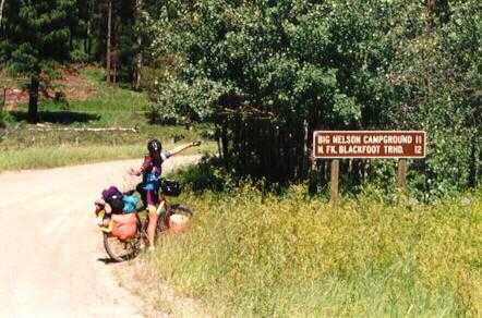
Finally, there's a fairly rough up/down/up to the Big Nelson Campground.
This is a beautiful site right 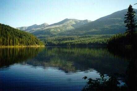 on
the bank of a small green lake. A very non-level site, though. We manage
to find enough almost-flat spots for most of the tents, but a couple of
people have to set up their tents up the hill next to the car park. Have
a great meal, topped off with some-mores (toasted marshmallows and chocolate
squished between Graham crackers; this of course requires the traditional
argument as to whether they are 'some-mores' or 'samoas') and then sit
down by the lake and watch some fireworks which the family camped next
door brought along. Carl puts his salesman skills to work, and talks them
into carrying out our trash in their car in the morning, so that we won't
have to carry it on the bikes.
on
the bank of a small green lake. A very non-level site, though. We manage
to find enough almost-flat spots for most of the tents, but a couple of
people have to set up their tents up the hill next to the car park. Have
a great meal, topped off with some-mores (toasted marshmallows and chocolate
squished between Graham crackers; this of course requires the traditional
argument as to whether they are 'some-mores' or 'samoas') and then sit
down by the lake and watch some fireworks which the family camped next
door brought along. Carl puts his salesman skills to work, and talks them
into carrying out our trash in their car in the morning, so that we won't
have to carry it on the bikes.
Tom and Melissa are way ahead. Today the second group consists of Alan, Carl, Judy, and Norm, while Al, Ann, and I bring up the rear. The three of us stop just past Reservoir Lake for lunch, sitting in the long grass under a tree beside the road. There I discover that I have yet another broken spoke, so I fix that. Then comes the climb up to the second summit; the one before the lake was at about 7000 feet, the second is about 500 feet lower. We pop over the top of that, and then have a long downhill cruise most of the way into Lincoln, with a little climb at the end. Pass a lot of huckleberry pickers at the side of the road, on the way down.
We hit Lincoln at about 2 PM, find the campsite, set up camp, and head
back into town. There are 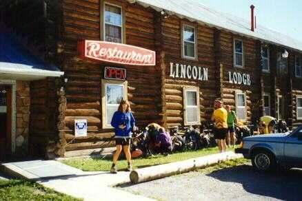 showers
at the Lincoln Lodge - very interesting old log-cabin two-story structure
- for a couple of dollars. And, there's a laundromat, so again everything
gets washed. Ann and I have volunteered to handle dinner tomorrow, so we
do the shopping for that - pasta and stuff, chocolate brownies for dessert.
Also stock up on what has become standard lunch food: bagels, fruit, and
aerosol cheese. This keeps without refrigeration, but it's important to
remember to cap it tightly before stowing it in a pannier. (Trust me.)
showers
at the Lincoln Lodge - very interesting old log-cabin two-story structure
- for a couple of dollars. And, there's a laundromat, so again everything
gets washed. Ann and I have volunteered to handle dinner tomorrow, so we
do the shopping for that - pasta and stuff, chocolate brownies for dessert.
Also stock up on what has become standard lunch food: bagels, fruit, and
aerosol cheese. This keeps without refrigeration, but it's important to
remember to cap it tightly before stowing it in a pannier. (Trust me.)
We take our stuff back to camp, startling a deer herd wandering around the site, and then head back to the Lincoln Lodge for dinner. After dinner, we have a campfire, the first of the trip. The campsite has a large stock of cut firewood, and when we arrived the attendant told us we could make ourselves at home with it. Toast the few marshmallows left over from yesterday. At some point in the early evening, I stick a 'Beware of the Dog' sign - acquired in Seeley Lake - on Alan's tent. Well, it seems funny at the time.
The route turns in Lincoln, but we've come a bit further east to get to the campsite, so we start off by heading back into town. Breakfast at the Lincoln Lodge - starting to feel like regulars there - and then back out to the mountains.
The day starts with a fairly uneventful uphill slog, for 11 miles. You know who are up in the front again. Somehow, the second group turns out to be Ann and I, with most everyone else somewhere behind - Norm is with us, if memory serves, and Carl passes us before we reach the turnoff. This is nice riding, with views out over the flatland ranches finally giving way to trees and mountains.
We find Carl waiting at the turnoff - a pair of dirt wheel-tracks through
the trees, which look more like it's probably someone's driveway. Ann and
I normally prefer a slower pace, so we decide to keep  going
- the other two are going to wait there for the rest of the bunch, and
then catch us up. The ACA map warns that this track is 'extremely steep'.
We wonder what they're talking about - it's rough, but not very uphill.
After about 3 miles of this gentle climb through the trees, we find out
- we hit a very steep and gravelly bit. We catch up with Tom and Melissa
here, as they stopped to admire the scenery a bit and to take some pictures.
All during the ride up through the trees, we pass deserted homesteads -
wood cabins, some still recognisable as such, and some collapsed into mere
piles of boards. We've heard that one of those had been the haunt of the
Unabomber - though some people insist that his cabin has been torn down
to discourage curiosity seekers.
going
- the other two are going to wait there for the rest of the bunch, and
then catch us up. The ACA map warns that this track is 'extremely steep'.
We wonder what they're talking about - it's rough, but not very uphill.
After about 3 miles of this gentle climb through the trees, we find out
- we hit a very steep and gravelly bit. We catch up with Tom and Melissa
here, as they stopped to admire the scenery a bit and to take some pictures.
All during the ride up through the trees, we pass deserted homesteads -
wood cabins, some still recognisable as such, and some collapsed into mere
piles of boards. We've heard that one of those had been the haunt of the
Unabomber - though some people insist that his cabin has been torn down
to discourage curiosity seekers.
 Tom
and Missy zap off in a cloud of dust, and Ann and I continue to slog up
the gravel. Eventually we hit the top, where there's a large flowery meadow.
Tom and Melissa are waiting there. This is the Continental Divide at last,
our first crossing. We stop for lunch and to take lots of pictures.
Eventually
the other 5 show up, so we have to have another picture session.
Tom
and Missy zap off in a cloud of dust, and Ann and I continue to slog up
the gravel. Eventually we hit the top, where there's a large flowery meadow.
Tom and Melissa are waiting there. This is the Continental Divide at last,
our first crossing. We stop for lunch and to take lots of pictures.
Eventually
the other 5 show up, so we have to have another picture session.
Finally we have a long, fast coast - at least the uphill slogs have payoffs - down to the Grady Ranches camping area. And past. Not at all obvious where it is, not aided by the fact that it has absolutely no facilities to help you identify it. It's simply a place where you are allowed to camp, with a nearby stream for water. We ride back and forth a bit looking for it, and finally find a large flat area with a fire ring, which we decide must be it. It's open and windy, but it's flat, and home for the night. One pair of pickup trucks passes by as we clean up after dinner. Carl flags them down, chats with them a bit, and convinces them to carry our garbage out for us. Handy fellow to have along. Since there's a fire ring and a lot of downed deadwood, we have another campfire.
Have a couple miles of downhill to start, past flat valley farm and ranch land hemmed in by mountains on both sides. Then begin the long, but not too steep, climb up to our second crossing of the Divide. This is largely through woods, on a rough dirt road.
Tom and Melissa set off early, and at high speed, because Tom is having
problems with his headset, 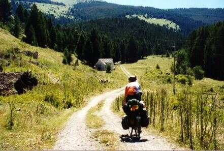 and
he wants to get to Helena before the bike shops close. After the first
hour or so, Alan also hares off, swearing that he will get to Helena
in time for lunch. The rest of us are riding together today. Somewhere
along this stretch, we're overtaken by two other riders, with one BOB
trailer
that it seems they take turns pulling. They say they've been following
our tracks for days, and that they've been able to tell they were getting
closer; they've been wondering when they'd finally catch up so they could
find out who we are. We have a quick chat with them, and then they take
off into the distance. They're packing in a lot more miles per day than
us.
and
he wants to get to Helena before the bike shops close. After the first
hour or so, Alan also hares off, swearing that he will get to Helena
in time for lunch. The rest of us are riding together today. Somewhere
along this stretch, we're overtaken by two other riders, with one BOB
trailer
that it seems they take turns pulling. They say they've been following
our tracks for days, and that they've been able to tell they were getting
closer; they've been wondering when they'd finally catch up so they could
find out who we are. We have a quick chat with them, and then they take
off into the distance. They're packing in a lot more miles per day than
us.
Along the way we pass a couple of ruined old mines - a new feature which
we see a lot of in the next 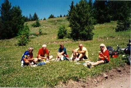 couple
of days. The first is surrounded by a mini ghost-town of maybe 6-8 ruined
houses; though a couple look like they're only in the early stages of
disintegration,
and may not have been uninhabited for that long. Eventually we hit the
second divide crossing, and stop on a grassy patch at the top for lunch.
As we're about to set off, I discover that I have another puncture - front
this time - so I patch that, and retape the front rim. (I'm deeply
suspicious
of my rim tape.)
couple
of days. The first is surrounded by a mini ghost-town of maybe 6-8 ruined
houses; though a couple look like they're only in the early stages of
disintegration,
and may not have been uninhabited for that long. Eventually we hit the
second divide crossing, and stop on a grassy patch at the top for lunch.
As we're about to set off, I discover that I have another puncture - front
this time - so I patch that, and retape the front rim. (I'm deeply
suspicious
of my rim tape.)
 The
afternoon begins with a ride across a large, beautiful bowl - mostly meadow;
a gentle run down one side, and back up the other - to our third crossing
of the Divide at Priest Pass. After the pass, there's a short dip and climb,
about a mile altogether; then, according to the ACA route, you 'begin long,
steep downhill'. Yes!
The
afternoon begins with a ride across a large, beautiful bowl - mostly meadow;
a gentle run down one side, and back up the other - to our third crossing
of the Divide at Priest Pass. After the pass, there's a short dip and climb,
about a mile altogether; then, according to the ACA route, you 'begin long,
steep downhill'. Yes!
This is a great downhill coast at high speed, down a pretty good dirt road - though there are a couple of exciting gravel patches. The adrenaline level is kept up, though, by the fact that the road is lit by dappled sunlight filtering through the trees, which means that you can't tell in any detail what the surface is about to be like until you hit it. I zip down this at high speed, and after about 5 miles take the turn up to the main road. I stop there, lean my bike up against the stop sign, take off my helmet, and lay in the grass looking at the sky, with a bag of pretzels on my chest. That was so much fun, I'm almost tempted to ride back up so I can do it again.
After a minute or two, Carl rolls up. He'd been right on my back wheel at the top, but said he felt like he almost lost it on one turn and decided to slow down a bit. The rest of the crowd show up some time later.
From there it's a long run to Helena along the road. This is gently downhill, but we have to pedal it anyway because a headwind has come up. We stop at the first Conoco we see to refuel - snacks and drinks which we put down while sitting in the small patch of grass in the shade of the building - and then head on to the ex-KOA campsite about 3 miles north of town.
After we settle in, we take a couple of cabs back into town for dinner at the Windbag, a very nice restaurant with very good food. (Until 1973, it had been a brothel. Lot of that in Montana, it seems.) This is Carl and Norm's last day with us. They'd only been able to manage the two-week option, and will be bailing out here. We give them each a signed presentation box of Jelly Belly jellybeans to remember us by. Eventually we cab back to camp to relax.
Breakfast at the all-you-can-eat pancake stand next to the campsite swimming pool. During breakfast, Bob and Sally show up. They're friends of Al's, and belong to the same club as he does. They've just finished an ACA-led ride along the same stretch that we're about to ride, and have been driven back to Helena at the end of the trip. We have a long chat with them, picking up some pointers for the days ahead. They've got a very nice off-road tandem which has been fitted with S&S couplings - can be taken apart and packed into two suitcases - so we also spend some time admiring it and being shown how the couplings work.
Rest day means laundry, of course. Also, bike maintenance. I tune my wheels - not convinced they're well built - during which I discover another broken spoke which I replace; and, a number of cracks developing in the back rim at the non-drive side eyelets. Yet another sign of an under- tensioned wheel. I checked to make sure they were true before starting this trip, but it never occurred to me that I might need to check the wheels on a new bike for whether they'd even been built right - not a bike from a quality maker, anyway.
Meanwhile, Judy buys Norm's folding knobbly spare tire, and mounts it on the front of her bike, swapping the old front to the rear. This is a new variant of the ritual, which previously involved only one end of the bike at a time. We say goodbye to Norm and Carl, who pack themselves up and head out to the airport in a hired car.
After, we all split up to look around town; which, it being Sunday, is mostly closed. Ann and I spend a fair amount of time exploring: finding where the bike shops are, and checking out the various tourist attractions like the cathedral (closed, on Sunday, would you believe it?), the Civic Center, the Capital building, the old Fire Tower, and so on.
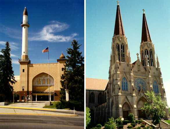 The
Civic Center is particularly intriguing. It looks like a mosque, complete
with minaret. It was originally built as a Masonic temple, and later given
to the city. There are two main hills in town, with the cathedral on one,
and this on the other, facing each other and at comparable heights. Both
were built during the same period of time. Considering the historic
relationship
between Catholics and Masons, it's tempting to wonder whether the two groups
were competing in building these two buildings in such a 'face-off' set
of positions.
The
Civic Center is particularly intriguing. It looks like a mosque, complete
with minaret. It was originally built as a Masonic temple, and later given
to the city. There are two main hills in town, with the cathedral on one,
and this on the other, facing each other and at comparable heights. Both
were built during the same period of time. Considering the historic
relationship
between Catholics and Masons, it's tempting to wonder whether the two groups
were competing in building these two buildings in such a 'face-off' set
of positions.
As pre-arranged, we all meet at 5:30 in Last Chance Gulch, where we have a windy dinner on the terrace of a restaurant, but retreat inside for coffee and dessert since it looks like a storm is brewing up. Then back to the campsite, where I have a nice long soak in the hot tub, joined for part of the time by Ann, Judy, and Missy.
Up early and pack before today's raid on the all-you-can-eat breakfast; then off into Helena through the rush-hour traffic to the grocery store. We distribute the group food among the bikes - we're carrying 2 days dinner and 3 days lunches - and hit the road. Tom and Melissa hare off as usual. Alan decides to lag behind for some reason, saying he'll catch up with us later. We stop at Glacier Cyclery on the way, both to say hi to Eric (a friend of Uncle Dave's) and so that I can stock up on spokes, since I seem to be going through them at a fair rate. Then up and out of town through Grizzly Gulch.
 I
don't actually find a lot to take notes about today. It's a hot, sunny
day, and we spend most of it riding uphill on a loose, sandy road. (All-day
average of 140 feet/mile of climb, an all-time high for Ann and I.) This
is a long slog, which we break by having lunch by a nice little meadow.
At about 3 PM we stop to filter water from a stream, to refill bottles
and CamelBaks. While we're doing that, Alan catches up with us; he crashed
a couple miles back, and is feeling a bit ragged, though fortunately there's
no serious damage either to him or to his bike.
I
don't actually find a lot to take notes about today. It's a hot, sunny
day, and we spend most of it riding uphill on a loose, sandy road. (All-day
average of 140 feet/mile of climb, an all-time high for Ann and I.) This
is a long slog, which we break by having lunch by a nice little meadow.
At about 3 PM we stop to filter water from a stream, to refill bottles
and CamelBaks. While we're doing that, Alan catches up with us; he crashed
a couple miles back, and is feeling a bit ragged, though fortunately there's
no serious damage either to him or to his bike.
 We
finally drag into camp at about 5. There's a formal campground at Park
Lake, but we stop at the informal sites about ½ mile before. This
means ½ mile ride to the pit toilets and the drinkable water, but
also a much more pleasant site. We're camped in the trees by the rocky
shore of a beautiful lake, with a few small islands in the middle.
We
finally drag into camp at about 5. There's a formal campground at Park
Lake, but we stop at the informal sites about ½ mile before. This
means ½ mile ride to the pit toilets and the drinkable water, but
also a much more pleasant site. We're camped in the trees by the rocky
shore of a beautiful lake, with a few small islands in the middle.
We play in the lake. Al has been claiming for days that it's possible to float using only two blown-up bike inner tubes, and now he proceeds to prove it to us. We pretty much all take turns at this - sitting in the tubes and floating lazily around. Eat dinner, and sit and watch an angler paddling around in a thing that looks like a large inner-tube with rubber waders attached, and then watch the sunset, and lightning over the mountains. Looks like it might rain overnight, so we batten down the hatches before tucking in for the night.
At some point during the course of the evening, yet another duck arrives - this one, a yellow plastic semi-silhouette about 6 inches high, with a spike base for sticking into the ground. Someone installed him just outside the entrance to our tent. He's christened Lawn Duck - imagination running a bit flat - which is later modified to Lon Duck, a far more dignified name. (Lon now has a place of honour in the back garden here in Bristol.)
 Cool
and drizzly this morning. This is probably just as well, as it keeps us
from blowing up on the climb out of Park Lake - about 8 miles, 2 of which
are absolutely unrideable, steep, rutted, rooted, narrow tracks through
the trees. This early part is complicated, and we aren't always sure we're
really on the right trail; though I suppose we must be since we hit all
the right waypoints on the ACA route. Near the top of the climb we're
overtaken
by Tom and Melissa. They'd been ahead (did I need to say that?) but missed
a turn and went a couple miles out of the way before realising it, and
backtracking to the trail.
Cool
and drizzly this morning. This is probably just as well, as it keeps us
from blowing up on the climb out of Park Lake - about 8 miles, 2 of which
are absolutely unrideable, steep, rutted, rooted, narrow tracks through
the trees. This early part is complicated, and we aren't always sure we're
really on the right trail; though I suppose we must be since we hit all
the right waypoints on the ACA route. Near the top of the climb we're
overtaken
by Tom and Melissa. They'd been ahead (did I need to say that?) but missed
a turn and went a couple miles out of the way before realising it, and
backtracking to the trail.
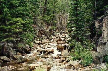 Eventually
we hit the top, and are rewarded by miles of coasting down into Basin.
Most of this is even reasonable dirt road, though there's one short - about
.2 mile - free-fall rocky section. Most of this is along Cataract Creek,
a beautiful, narrow, twisty tree-lined gorge with a lively creek leaping
down the rocks beside the trail. There are several old abandoned mines
along this stretch - and a lot more after Basin.
Eventually
we hit the top, and are rewarded by miles of coasting down into Basin.
Most of this is even reasonable dirt road, though there's one short - about
.2 mile - free-fall rocky section. Most of this is along Cataract Creek,
a beautiful, narrow, twisty tree-lined gorge with a lively creek leaping
down the rocks beside the trail. There are several old abandoned mines
along this stretch - and a lot more after Basin.
In Basin we stop for lunch at Rose's Café. Burger, coffee, pecan pie. I order a chocolate milkshake, and suddenly everyone else decides that would be a good idea, too. Keeps the waitress busy for a while, and cleans them out of chocolate ice cream.
After lunch we spend a bit of time wandering around Basin. It used to be a thriving community, and relatively large (for Western Montana) but the local economy was hit hard when the mines shut down. Basin is now trying to re-invent itself as an artists' town, much as Big Fork seems to have done. We spend some time talking to two young kids (Jasmine and her little brother), and their dog Rika, who are playing with a BMX bike on the main street. Then we check out the local pottery shop, where I have to tell the story of Big Duck to a woman who saw us ride by, and wants to know why on earth I'm carting him around.
One of the old buildings in Basin has been spruced up a bit, and has a sign saying it's an 'Artist's Refuge'. 'Artist's Refuge', I wonder, 'What's that? A place where you're not allowed to shoot artists?' It appears to be closed, though.
Finally leave Basin on what ACA call an 'unmaintained cattle access road' parallel to the Interstate. A long but gentle climb until the Interstate turns south, the access road crosses under it, and suddenly we're faced by a Bristol-style hill - not very long, but definitely a climb. As we reach the bottom and look up, Alan exclaims, 'That is ****ing steep!'. This is the first time in the whole trip that sort of language has been heard to cross Alan's lips, and by that we know that this is, indeed, a serious little hill.
With a lot of push, and some fighting to keep the front wheel on the ground, I manage to ride up it, much to my surprise. I know Alan does too, because he's right beside me. I'm not sure about everyone else; I'm too busy concentrating on catching my breath and getting my heartbeat back under the red line to really pay attention. At the top it reverts, mercifully, to a very gentle climb, almost flat. We're now on an abandoned railway roadbed. We follow that along for a few miles, through a tunnel, and on to the Mile 174 camping area. As you might guess from the name, this is another rough campsite in the middle of nowhere, with no facilities other than a fire ring. We set up camp among the trees.
Melissa is feeling poorly, and she just sets up her tent, climbs straight into it, and doesn't come out until morning. Some sort of stomach trouble; I had a bit of that yesterday, but nothing like what she seems to have picked up.
Rains in the evening, so after a quick dinner we retire to our tents. Finally get around to writing our postcards to send to all the folks back home.
Quick breakfast, up, and out. Missy is back to being her usual perky self, which is good.
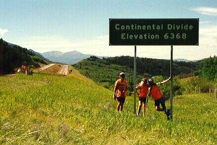 This
is a pretty non-descript short day, consisting of 10 miles of gentle climb
along the old rail line and a bit of frontage road, culminating in our
fourth crossing of the Divide where we stop for some silly pictures. Then
comes a fast 8-mile coast down the shoulder of Interstate 15, into Butte.
The scenery is pretty, but not dramatic, and it's marred by the highway.
This
is a pretty non-descript short day, consisting of 10 miles of gentle climb
along the old rail line and a bit of frontage road, culminating in our
fourth crossing of the Divide where we stop for some silly pictures. Then
comes a fast 8-mile coast down the shoulder of Interstate 15, into Butte.
The scenery is pretty, but not dramatic, and it's marred by the highway.
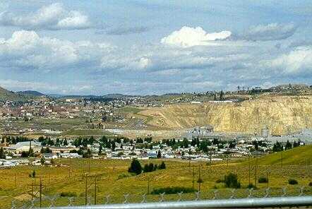 We
stop at the 'scenic overlook' halfway down the hill. Since Butte is
dominated
by the huge pit and piles of mining spoils, it's sort of a strange use
of the word 'scenic', one which normally wouldn't occur to me, but it's
impressive, if only as an example of how drastically we can ravage our
environment. While we're there a woman pulls up, climbs out of her car,
and sits up on the hood drinking mineral water spiked with Ginseng from
a blue bottle. We go over to chat to her.
We
stop at the 'scenic overlook' halfway down the hill. Since Butte is
dominated
by the huge pit and piles of mining spoils, it's sort of a strange use
of the word 'scenic', one which normally wouldn't occur to me, but it's
impressive, if only as an example of how drastically we can ravage our
environment. While we're there a woman pulls up, climbs out of her car,
and sits up on the hood drinking mineral water spiked with Ginseng from
a blue bottle. We go over to chat to her.
She turns out to be a local. A lawyer, moved back to Butte after spending a few years in Washington DC. She says she'd been having a bad day at the office, and when it finally came down to choosing between murdering her secretary and getting some fresh air, she decided to come up to the viewpoint. We talk to her for a while about her, and us, and what we're all doing here. You can see pretty much all of Butte from up there, so she points out some of the interesting areas and tells us about the city.
Later, we roll into the Butte KOA, to find that the tent area is right next door to the espresso hut. (As a result of which, Judy's in heaven.) Surprise, our lady lawyer phoned down to them, and told them that she's paying for our first round of coffees. We send her a postcard of thanks later.
Short day and luxury campsite, of course, means 'laundry', and we do that again. I ride up the hill a bit to an outdoor shop, and find a couple of OR waterproof stuffsacks which I immediately make mine.
The KOA is right next to the new Tourist Office building, and we catch the tourist trap 'trolley' from there for a ride around town to see the sights, including the huge pit mine - 1 mile across, and the deepest shafts are said to go 1 mile deep, right back down to sea level. This pit has been closed for years - it was bought by a company which owns another large pit mine elsewhere in the world, and who shut it down after buying it. Presumably this was to keep the price up for their other pit.
A few years back they turned off the drainage pumps, and the pit is filling with water - a lot faster than was expected, and it's highly polluted stuff. They reckon it's not going to be much longer before it reaches the level of the underground drinking water supplies, and when and if that happens there will be a major problem. Preventing that will also be a major problem - expensive getting the pumps restarted, and the water is so polluted that it will need (expensive) treatment before it can be put anywhere else.
After, we walk a mile or so to a Mexican restaurant - have a good meal, topped off with fried ice cream for desert. (Who'd have believed you could fry ice cream?) Then do some shopping on the way back.
During the afternoon, I found an advertising leaflet for 'Al's RV Shop'. Cut off the top banner - which looks more or less like a shop sign - and attach it to Al's tent.
After bedtime, we have a really impressive thunderstorm. Glad we tie everything down. There's another party next door, with a large frame tent that they don't bother to stake down. During the storm, it starts to 'walk' in the heavy wind, and we hear them out in the rain in the middle of the night, pegging it down.
Up and out dry this morning, for a change. Tom and Melissa set off up ahead and are soon out of sight. The rest of us tool around town, out onto Continental Drive. Suddenly, Tom and Melissa flash past. They stopped at a gas station to put some air in their tires. We don't see them again until the campsite.
We head down Route 2 with occasional stops - to visit trees, replace one of my pannier hooks, and play with Judy's drivetrain which has developed a mysterious tick. Then, about 50 yards before our turnoff onto a dirt road into the woods, we spot a group of 5 or 6 cyclists coming the other way. We stop and flag them down. They turn out to be a Scottish family - from Cupar in Fife, which is near where Ann's mom lives - and they're doing the transAmerica route from east to west. Strange coincidence - and if we'd been a minute earlier, we would have been off into the woods and missed them.
After the turnoff back onto dirt there's a nasty climb up through Thompson Park and on up over the hill. We stop at the viewpoint to look back at Butte - allegedly the Berkeley Pit dominates the view of town even from this distance, but it's foggy off in the distance and hard to make out.
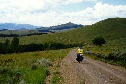 Then
it's on up to our fifth Divide crossing. This is a funny one; due to the
squiggles in the ridge line, we're crossing from the west to the east side
of the Divide, by riding from east to west. We have lunch in a small woods
at the top. It's threatening to rain. Strangely, 5 young lads stroll by,
and stop to ask how far it is back to the highway. They seem out of place,
and un-equipped for a mountain walk, but we don't discover what they're
doing up there, especially not knowing where they are. During lunch we
also do a bit of bike maintenance. Alan finally identifies and cures Judy's
tick; I eliminate my creak, which turns out to be a loose cleat.
Then
it's on up to our fifth Divide crossing. This is a funny one; due to the
squiggles in the ridge line, we're crossing from the west to the east side
of the Divide, by riding from east to west. We have lunch in a small woods
at the top. It's threatening to rain. Strangely, 5 young lads stroll by,
and stop to ask how far it is back to the highway. They seem out of place,
and un-equipped for a mountain walk, but we don't discover what they're
doing up there, especially not knowing where they are. During lunch we
also do a bit of bike maintenance. Alan finally identifies and cures Judy's
tick; I eliminate my creak, which turns out to be a loose cleat.
 After
lunch there's a nice quick down-and-up across a sage-meadow bowl. I have
yet another flat (rear) and stop to fix it while the others go on; then
set off to catch up. There's a long stretch of rough but basically down,
followed by a short steep climb where Ann is waiting for me. Then
we have a really nice long coast down to Interstate 15 where we catch up
with Al, Alan, and Judy.
After
lunch there's a nice quick down-and-up across a sage-meadow bowl. I have
yet another flat (rear) and stop to fix it while the others go on; then
set off to catch up. There's a long stretch of rough but basically down,
followed by a short steep climb where Ann is waiting for me. Then
we have a really nice long coast down to Interstate 15 where we catch up
with Al, Alan, and Judy.
Our dirt road passes under the Interstate. We stop there for a snack break, and it starts to rain. We shelter from a marvellous thunderstorm under the north-bound lane of the Interstate overpass.
Finally there is a long but fairly gentle climb up the side of Mt Fleecer to Beaver Dam campsite. The site is nice - and the resident warden let us set up in one of the picnic sites, instead of in the middle of the trailer/RV area. We have a walk around, but decide there's not a beaver dam there, any more. We do find a very nice 'beaver-dam meadow'. What happens is that a beaver dam creates a lake. This eventually fills up with silt, producing a large flat clear area in the valley. Then the neighbouring trees seed the area, but these new trees are much smaller and younger than the surrounding forest. Once you've had this explained to you, these things are easy to see.
After dinner we realise that this is our last 'camp' dinner. We celebrate by ditching large quantities of unused group spices, the almost dead frying pan, and other assorted stuff - thus lightening our load for the last couple of days. This involves a lot of arguing over what is/isn't essential/worn- out, and a great deal of merriment.
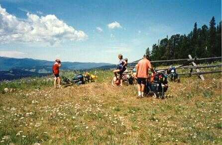 A
long climb out of camp, and then after 4 or 5 miles an incredibly steep
climb up a meadow path for ½ mile, about half of which I manage
to ride. As we hit the turn near the top of that, we spot Tom and Melissa
returning from yet another wrong-way excursion up to the top of the
mountain.
There really is no obvious track here, and they missed the subtle cue that
it was time to turn off.
A
long climb out of camp, and then after 4 or 5 miles an incredibly steep
climb up a meadow path for ½ mile, about half of which I manage
to ride. As we hit the turn near the top of that, we spot Tom and Melissa
returning from yet another wrong-way excursion up to the top of the
mountain.
There really is no obvious track here, and they missed the subtle cue that
it was time to turn off.
Following this comes a downhill stretch, including a really steep two-tenths mile down through a sage meadow. This is too steep to ride, and too steep to walk straight down - rather, you have to take wide traverses back and forth through the meadow. Even Tom decides to walk this, after trying to ride it and dropping his bike - I'm pretty sure this is the only part he didn't ride. For myself, when I see Melissa get off and start walking, I know there's no chance that I'm going to be able to ride down it and live.
Finally we hit the fire road, reasonably nice dirt, and are rewarded with a scenic and mostly downhill run to Wise River where we're going to have lunch. We stop a couple miles outside town to chat with a fellow who's raking the road where it runs alongside his property. He recommends the Wise River Club for lunch, so we go there after a stop at the Post Office for people to mail things home. The café/hotel/shop (for such it is) is obviously oriented towards hunting and fishing. And, another indicator of the tension between the environmentalists and the folk making a living from the land, they have a sign:
While we're eating, a huge thunderstorm brews up. We think it's going to pass off to one side, but the lady in the café tells us that, no, the road turns here and we're going to be heading right into it. Tom and Melissa are already way ahead. The rest of us decide to sit around for a while. Finally the storm eases off a bit, and Ann and I set off into it. I think that Judy and Al are suiting up to come along, but they don't.
Ann and I have a long death climb through the pouring rain, up the valley towards Elkhorn. After about 1¾ hours, a fellow passing by in an RV slows alongside us and tells us that Judy and Al left the café 'about 30 minutes ago'. We find out later that Alan stayed for another half hour after that.
There's a lull in the rain as we climb to the plateau above Elkhorn. About 4 miles from the crest I flat again, and just as I finish repairing it the thunderstorm returns. We climb the last bit, and then have a cold, dark, wet coast on gravel down to Elkhorn. Ann falls on this stretch, knocked off balance by a rubber anti-erosion strip running diagonally across the trail. This is always un-nerving, as she injured a knee some years ago in a skiing accident, and that knee is a bit delicate. Fortunately she's sore but undamaged.
We pull up to the Elkhorn Lodge, freezing and wet. All the lights are out ('oh no, is it closed?') but we spot Tom's and Melissa's bikes up on the porch, so we take ours up there too. We head inside, where a life-saving waitress pops up with two cups of coffee. Tom and Melissa are eating, by candle-light; the electricity went out maybe 15 minutes ago. The lodge says they can't make any more real meals - imagine relying on electricity to cook, in a place as isolated as this - but the soup pot and the coffee pot are both still hot, so they rustle us up a munch of soup, coffee, and pie.
The plan was to have dinner at the lodge, and then head a mile or so further on to a campsite. The four of us sit here, eating and discussing our options. Option A is to stick with the plan - back out into the cold, wet, windy night to ride a couple miles to the campsite and set up our tents in the mud. Option B is to get out the plastic, and go upstairs. 'Hey,' says Tom, 'this is a real no-brainer.'
We cart our luggage up to our rooms, and lay things out to dry on every available surface. Then Ann and I go up to the hot spring. The lights are out - and the showers, which must use an electric pump. But the springs themselves are still running - isn't Mother Nature clever? - and so we just sit in them for quite a while, soaking and warming up. Wonderful. Have a chat with another couple, who're staying in an RV down at the campsite. They invite us to drop by in the morning, on our way out; unfortunately we get off to a late start the next day and so don't manage that.
Once we're feeling well-poached, we head back to the lodge for bed. Al, Alan, and Judy never do show up; we're slightly worried, but not too much so since we know they have cookware, emergency food, water, shelter, and a stove. Find out later they bailed out at Little Joe campsite, before the climb up onto the hill above Elkhorn, when the rain started again and they realised they were running very late.
Funny complaint - the bed in the lodge is too comfortable to sleep right. I've obviously become attuned to my lightweight ThermaRest.
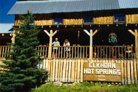 Last
riding day. We're down for breakfast at 730. The electricity is back -
though the phone is still out - so we think they could manage that. Oops,
they don't start serving until 8. We have a wonderful breakfast, and mess
around a bit - hoping the 3 lost sheep might show up - before finally
setting
off at 11. (We learn later that they arrived at the lodge at about 1130.)
Last
riding day. We're down for breakfast at 730. The electricity is back -
though the phone is still out - so we think they could manage that. Oops,
they don't start serving until 8. We have a wonderful breakfast, and mess
around a bit - hoping the 3 lost sheep might show up - before finally
setting
off at 11. (We learn later that they arrived at the lodge at about 1130.)
As usual, Tom and Missy are off the front. Just Ann and I riding together for this last day of the trip.
There's a long, scenic, gravelly downhill to Polaris. This has the honour of having the smallest US Post Office, so we stop to admire that, and also a yellow-diamond 'Walt Crossing' sign. (Anyone knows the story behind that, do let me know.) Then on for a couple of more miles before having my first flat of the day. My rim is chewing the bead from the tire. I'm managing to keep it rideable by generous use of glass-fibre reinforced strapping tape, but every so often something sneaks through and punctures the tube. (Mental note, carry a folding spare tire next time. The 'group' has one or two, but we don't.)
Eventually we hit the paved road, a long level stretch followed by several miles of climb up to Badger Pass. Before the pass we stop to chat with 2 transAmerica riders heading the other way. They've seen Tom and Melissa, who they guess are probably '4 miles ahead' at this point. They haven't seen Al, Alan, and Judy, so we decide they're behind us; we hadn't been sure, but this seems to make it pretty certain.
Part way up the climb we stop for lunch. We can see a long way back, so I keep scanning with the binoculars to see if I can spot the lost 3, but never do. After lunch we finish the climb, and begin the incredibly long coast down towards Dillon. About 2 miles before the Interstate I flat again. The bead is separating, so it's patch the tube and throw some more fibre tape onto the tire, and then finish the run down into town. About 50 yards before the turn onto the main street, the tire finally dies completely - a dramatic blow-out. It's only about a mile or so to the campsite, so I consider just pushing the bike there, but it refuses to cooperate.
It's only about 4 PM, so I send Ann on to find the bike shop and buy me a new tire. While I'm taking the old one apart and patching the tube, Judy and Alan arrive. After the obligatory wisecracks, Judy lends me her folding tire. I install that, but the patched tube won't hold air - obviously more holes than I think. As I'm dismounting the tire again, Ann shows up, with a new tube and a Conti Cross Country tire, so I put those on - noting, in the process, yet again another broken spoke. I limp on to camp.
At the campground, I replace the spoke while Ann sets up the tent. I dig out the 'Sorry, we're closed' sign which I bought in Big Fork, and attach it to Judy's tent. We clean up and shower, and head up to the local college, where the Patagonia folk are sponsoring a bluegrass and chili event. Alan, Judy, Missy, and Tom have already eaten when we get there, so Al, Ann, and I set out to find dinner, and eventually end up at Papa T's. This is a 'family restaurant', but I'm not sure why. In the Southwest, 'family' seems to be a euphemism for 'dry', but Papa T's serves beer.
I have a small propane cylinder to get rid of. I wander the site, trying to eyeball everyone's stoves and lanterns surreptitiously. Eventually I find a couple who are using those. They're a bit suspicious at first - 'What's the catch?' - but after chatting for a while I manage to convince them there's no catch. I simply have a cylinder which is about ¾ full. I can't take it on the plane tomorrow. I have to throw it away, or to find someone who can use it. I hate throwing things away. I've been halfway around the site, and they're the only people I've spotted using these. If they can use it, it's theirs. They take it. We talk a bit more - they're doing a large loop motorcycle tour around the Rockies. Later, they wave as they pass our site on their way out.
We head into town to find the bus station and ask about our bikes. Most of the group arranged for one of the local bike shops to send their bikes to their homes UPS. However this didn't seem like a viable approach for the two of us, living outside the US, so we're going to fly out of Butte with our bikes. Problem, how to get to Butte with them. They might be able to go on the bus. If not, we have to ride up there today, and we need to get started. The 'bus station' turns out to be a combination gas station and small store, which also sells bus tickets. The fellow there says he'll have to ask the driver when he comes through on his outbound trip, but he's pretty sure it'll be OK. He sounds sufficiently positive that we decide to chance it.
Ann, Judy, and I head over to the Lone Star for breakfast. We're blessed with what has to be the most dozy waitress in the known universe - I diagnose it as brain death, probably about a week ago. Find out she's really just marking time waiting for the owner to come in, so she can resign. We end up doing most of our own waiting - go get the menu, go pick up the food, go find the silverware, There's a woman from California at the next table, visiting her daughter at the college. She's having similar luck. Waitress tells her she's 'having a bad day'. She tells the waitress that's a shame, but she doesn't see why that should be our problem. Waitress opines that people from California have no manners. Another couple of fellows come in, who are in the area for some fly-fishing. They sit there unnoticed while we eat, and finally get up and walk out. We finish and leave, after finding someone we can pay. Judy says this may be the first place where she hasn't left a tip since her college days.
The three of us head over to the Patagonia outlet and then on to the bike shop, picking up the others on the way. Al, Alan, and Judy are having their bikes shipped back. Tom and Melissa sent theirs yesterday, through the other bike shop. Of course being without the bikes leaves them the problem of what to do with their panniers - not even lunchtime, and the bus doesn't go until 5. The bike shop owner says it'll be OK for everyone to leave their bags in the shop until bus time. He's going to close for the day at lunchtime, but he gives Judy a key so that they'll be able to get their bags back. 'Just lock up and push the key through the mail slot when you're done.'
Off to lunch, all 7 of us, at Papa T's, and then back through town to the Dairy Queen for blizzards. We then wander around a bit, investigating the town. Mostly closed, it being Sunday. We check back at the bus station; the bikes will be OK on the bus. We sit around the park for a while, talking to a woman who's sun-drying a just-washed small cat. Poor thing has brain damage, she says; can't wash itself, so she has to give it a bath now and then.
Finally decide we've pretty much exhausted the possibilities, so we
head back over to the bus station to wait for the bus, due about 5. The
lady there now says the bus is running about an hour late, so we hang around
the pumps for a while - occasionally wandering back in for another bottle
of ice tea or cup of coke.  Then
we go across the street to sit on the sidewalk in the shade of a building,
looking like a bunch of derelicts. In fact, Judy, Tom, Al, and Alan have
the idea first and are all there when I go across. The image is so strong
- row of people with their bottles, propped up against the wall - that
I toss each of them a penny as I walk by, before taking my place in the
row. Al and Alan notice that a particular 4x4 full of young women has been
cruising by every 10-15 minutes, so we take bets as to how many more times
they'll go past before the bus comes.
Then
we go across the street to sit on the sidewalk in the shade of a building,
looking like a bunch of derelicts. In fact, Judy, Tom, Al, and Alan have
the idea first and are all there when I go across. The image is so strong
- row of people with their bottles, propped up against the wall - that
I toss each of them a penny as I walk by, before taking my place in the
row. Al and Alan notice that a particular 4x4 full of young women has been
cruising by every 10-15 minutes, so we take bets as to how many more times
they'll go past before the bus comes.
One of the things I've picked up in Dillon is a book, 'The Greenhorn's Guide to the Woolly West' by Gwen Petersen. Reading it at home later, I discover this is standard practice.
[High school] boys, crammed four to the seat, drive down Main Street, turn right, go up Second Street, turn again, and blast back up Main.
High school girls drive their vehicles in the same pattern but in opposite directions. As they pass by each other, the two groups whinny.Finally it shows up. We load ourselves on - bikes are a bit tricky - and head off for Butte. We entertain ourselves by watching out the window to see if we can spot the underpass we sheltered under a few days ago, and by trying to spot landmark mountains which we rode up. Finally we arrive in Butte and unload. The bikes are a hassle because they've intertwined themselves a bit, but we eventually sort it all out. Everyone else - and our luggage - heads off in the motel shuttle. Ann and I cycle over, only getting a bit lost on the way.
Quick shower and change, and then over to Lydia's for dinner. All in one car, which Alan reserved earlier; Al tried to get a second one on the spot, but there were none free. Lydia's is a fancy restaurant, recommended by a fellow we met in the campsite when we passed through Butte earlier. Lots of stained glass. We have a celebratory meal and toasts all around.
Motel room is too hot - at least 60 - so we turn on the air conditioner to try to get it back down to the kind of temperature we're used to.
No one at the desk, and Ann eventually invades the 'staff only' office to find someone who can check us in. They don't have any bike boxes, so we set up the bikes to travel nude, and strap our panniers together. We check in, and go to sit in the waiting area. After about 15 minutes or so, we're paged. They've found their bike boxes after all, so we box up the bikes and go to wait some more.
Just before the boarding area opens, the other 5 pull up. Judy, Tom, and Missy are on a flight only about 30 minutes later. So, we manage a last quick round of photos and hugs. Then out onto the plane. This is the smallest commercial plane I've ever been in, a tiny 18-seat turboprop. When we checked in, we were assigned seats 5A and 5F. I wondered why we were being seated so far apart. Turns out we aren't. 5A is the left-hand window seat, 5F the right-hand window seat. But, that's all the seats there are in a row; they're also both aisle seats. Headroom is non-existent, and I have to crouch to get in and walk up the aisle. I'm really not sure where they put the bikes - roof rack, maybe?
Alan told us that flying out of (and into) Butte is like a toilet bowl. Going out, you just keep circling and circling until you've got enough height to clear the surrounding mountains. It's hazy, but just clear enough to see the mountains below. Some of it even seems to look familiar, but maybe I'm just kidding myself.
Copyright © 1997 - Paul E. Smee - All rights reserved.